Skip to Main Content

The Road to...

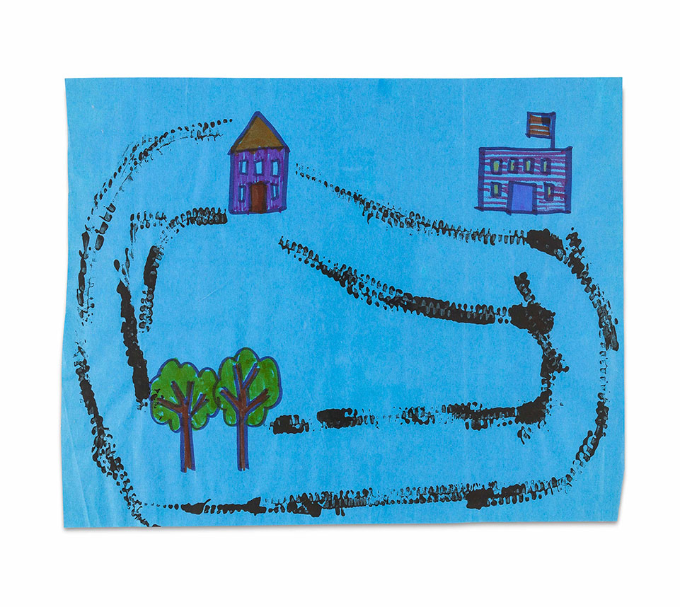
Introduce young students to maps by having them create their own map with lines for roads printed with car wheels.

Lesson Plan

Supplies Needed

Gather all the supplies needed to bring your craft ideas to life! From paints and markers to glue and scissors, our crafts section has everything to spark creativity and make every project truly special.

Steps

  • Step 1

    Read "Along A Road" by Frank Viva or "Truck" by Donald Crews. Discuss traveling and transportation topics presented in the story. Ask students to retell the parts they liked best.

  • Step 2

    Introduce maps and explain how they show a birds-eye view of roads, streets, and places along the roads.

  • Step 3

    Ask: What might we see along a road? List student responses along with a simple illustration next to each word.

  • Step 4

    Distribute 12" x 18" construction paper and Crayola ultra-clean washable markers, Crayola crayons, or Crayola construction paper crayons. Ask students to draw a couple of things from the list in different areas on their paper. Encourage them to draw something high, something low, and something to the right or left.

  • Step 5

    Demonstrate how to print roads that people would travel on to get from one place to the other. Roll a toy car or truck in a paper plate or shallow baking tray holding a little bit of paint, then roll the vehicle across the paper to mark a road from one landmark to another. Encourage students to stand while they print the roads.

  • Step 6

    Invite students to explain how to travel around their map. Encourage them to use positional words to describe locations on their maps.

Standards

MATH: Describe objects in the environment using names of shapes, and describe the relative positions of these objects using terms such as above, below, beside, in front of, behind, and next to.

SS: Examine the interaction of human beings and their physical environment, the use of land, building of cities,and ecosystem changes in selected locales and regions.

SS: Construct and use mental maps of locales, regions, and the world that demonstrate understanding ofrelative location, direction, size, and shape.

SS: Interpret, use, and distinguish various representations of the earth, such as maps, globes, and photographs.

VA: Create and tell about art that communicates a story about a familiar place or object.

VA: Use a variety of artmaking tools.

VA: Engage in self-directed play with materials.

Adaptations

Examine maps from an atlas and identify which places are land and which are bodies of water. Let students add landforms, water, and other landmarks to their maps.

Place large maps along with miniature animals, cars, and houses in one of their centers. Students can use them to set up models of places for people to live.

Help students create a map of the playground or the classroom.